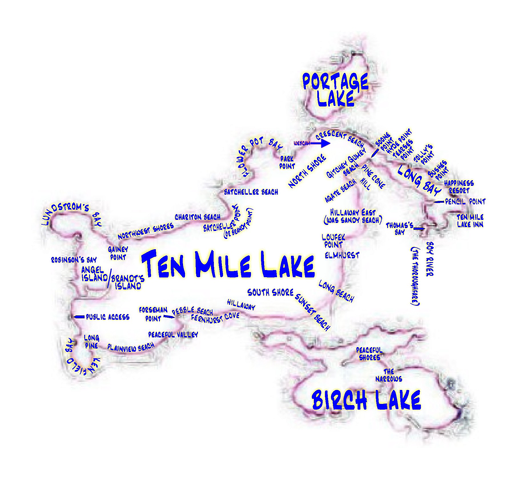
This map was provided by Geoff Cox. Please feel free to send me additional landmark information to be included here!
Landmarks:
- Web Cam: Brought to us by Bob Iverson.
- Agate Beach & Pine Cone Hill: “Agate Beach and Pine Cone Hill are located near the Ducharme(sp?) property and was owned by my Aunt Zelda Johnson until it was sold. We used to hike over there and play on the hill and look for agates on the beach. Yes, at one time you used to be able to walk the shore and not get wet. I found an old bass oreno lure there years ago.” – Steve Helscher
- Boone Point: “Boone point was named because when my grandfather bought and plotted the land, he sold it to his friends from Boone, IA. This was during the late teens during the 1900’s. … Across from Boone Point was a cabin owned by the Hyde family [currently Bob Crom’s property]. The family sold the Hyde cabin to my Aunt Zelda Johnson in the early ’60s. The cabin was moved across the ice on wooden rollers and placed on Boone Point. It is still in the family and members of the Hyde family still visit Ten Mile.” – Steve Helscher
- Loufek point: The Loufek’s “bought it from the Caniers who were also from Boone IA.” – Steve Helscher
- Boy River: “…also known as ‘The Thoroughfare’. My grandparents would use it to go to Hackensack to get groceries.” – Steve Helscher
- Thomas’s Bay: “Albert Thomas owned a lot of land in that area of Long Bay. Mom used to get eggs, chickens, etc. there when I was growing up. You can still see some of the out buildings up on the hill. I believe the land belongs to the state or the DNR (not really sure). When mom was growing up, and there during the summer, she and her sisters and the Hyde brothers would use the cattle paths for their walks. The cattle always avoided the swamps somehow.” – Steve Helscher